Rotterdam is a city that refused to stay in the past. After the devastation of World War II, it reimagined itself as a laboratory of modern architecture, earning the nickname 'Manhattan on the Maas.' This self-guided walk invites you to explore the dramatic riverfront, where the city's most iconic silhouettes meet the water. As you follow this walking route, you will transition from the bustling city center to the quiet, historic charm of Noordereiland, a unique island that feels like a tranquil village floating in the heart of a metropolis. The primary focus of this journey is photography, offering countless opportunities to capture the interplay of light, steel, and water. You will encounter the industrial majesty of De Hef, a decommissioned lift bridge that stands as a monument to Rotterdam’s maritime heritage, and the striking red spans of the Willemsbrug. This neighborhood stroll is perfect for those who want to see the city from a different perspective, away from the standard tourist paths. Whether you are a professional photographer or just looking for the perfect shot for your social media, the vistas along the Boompjes and the Maaskade provide the ultimate backdrop of glass and steel. Unlike a traditional guided tour Rotterdam might offer, this self-guided adventure allows you to wait for the perfect light at sunset or linger by the water as the city lights begin to twinkle. Discover the stories behind the bridges and the resilient spirit of a city that continues to build toward the sky. This is more than just a walking tour Rotterdam enthusiasts recommend; it is a visual journey through the heart of the Netherlands' most modern city, showcasing how old industrial relics and cutting-edge design can coexist harmoniously. From the wide-angle views of the Erasmusbrug to the intimate details of the historic ships docked at the quay, your lens will find plenty to focus on. Explore independently and at your own pace, ensuring you catch every reflection on the Maas.
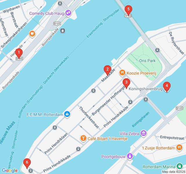
Numbers indicate the order of stops on the tour
Welcome to the Boompjes, one of Rotterdam's most famous riverside promenades. The name literally translates to 'little trees,' referring to the lime trees planted here back in the 17th century to reinforce the quay. While the original trees are long gone, this stretch remains a vital artery of the city. As you look across the water, you get your first major view of the 'Kop van Zuid' skyline, including the towering De Rotterdam building. This is a perfect spot to capture the scale of the Maas River and the constant movement of water taxis and cargo ships that define this port city's character.
Crossing over to the Noordereiland, you find yourself on the Maaskade. This island is a rare part of the city that largely survived the 1940 bombings, offering a glimpse into pre-war Rotterdam. The Maaskade is lined with elegant 19th-century buildings and historic ships often moored along the quay. From here, look back toward the city center; the contrast between the historic residential island and the shimmering glass skyscrapers of the Stadsdriehoek creates a stunning depth for your photos. It is a quiet, local favorite for those seeking a peaceful view of the river's bend.
Take a moment to wander into the heart of Noordereiland. Known as 'the village in the city,' this neighborhood has a distinct, artistic vibe. It was created in the 19th century when the Koningshaven canal was dug, effectively turning this peninsula into an island. Because it is surrounded by water and has limited car traffic, it feels worlds away from the high-rise energy just across the bridges. Keep an eye out for local street art and the 'Montmartre' feel of its small squares. It’s a protected cityscape, meaning the historic architecture you see here is carefully preserved to maintain its unique character.
Standing before you is De Hef, arguably Rotterdam's most beloved industrial monument. Formally known as the Koningshavenbrug, this railway lift bridge was completed in 1927. It was the first of its kind in Europe, featuring a central span that could be hoisted up to allow large ships to pass. Although it hasn't carried trains since 1993, it remains a permanent fixture of the skyline. Its dark steel girders and geometric silhouette are a dream for black-and-white photography. It represents the gritty, hardworking soul of Rotterdam that persists even as the city modernizes around it.
Often overshadowed by its neighbor, the Erasmusbrug, the Willemsbrug is a masterpiece in its own right. Known locally as the 'Red Bridge,' this cable-stayed structure was completed in 1981. Its bright crimson pylons provide a vivid pop of color against the often-gray Dutch skies. From the pedestrian paths, you get an incredible perspective of the river stretching toward the port. The bridge is named after King Willem III, and it serves as a vital link between the city center and the southern districts. Try capturing the cables in a leading-lines composition for a classic architectural shot.
You have reached the western tip of Noordereiland, known as Prinsenhoofd. This is arguably one of the best viewpoints in the entire city. From this single vantage point, you can see the Erasmusbrug, the Willemsbrug, and the vast sweep of the Maas River as it flows toward the North Sea. It is the perfect place to end your self-guided walk, especially if you have timed it for sunset. As the sun dips below the horizon, the city lights begin to reflect in the water, transforming the skyline into a sparkling panorama. Take your time here to capture the final shots of your journey.
Download Zigway to experience "Maas River Front & Skyline Photography" with AI-powered audio narration. Walk at your own pace while stories unfold around you.
 Easy
EasyRotterdam, Netherlands
Explore Rotterdam’s cultural heart on this self-guided walk through world-class museums, modernist villas, and futuristic architectural landmarks.
 Moderate
Rotterdam, Netherlands
Explore Rotterdam’s lush side through secret gardens, historic harbors, and the elegant 19th-century Shipping Quarter on this self-guided walk.
 Easy
EasyRotterdam, Netherlands
Explore Rotterdam's neon-lit streets and vibrant nightlife at your own pace with this independent audio walk through the city's coolest districts.
 Easy
EasyRotterdam, Netherlands
Discover Rotterdam’s seafaring soul on this self-guided walk through the historic Old Harbor, iconic skyscrapers, and maritime landmarks.
 Easy
EasyGdansk, Poland
Discover the 'Baltic Gold' on this self-guided walk through Gdansk's historic mills, massive cathedrals, and the magical Mariacka Street.
 Easy
EasyWarsaw, Poland
Explore Warsaw's scenic riverfront, rooftop gardens, and industrial-chic architecture on this self-guided stroll through the Powiśle district.
 Moderate
Krakow, Poland
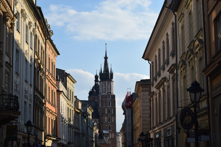
Discover Krakow’s stunning skyline and riverside charm on this self-guided audio walk through scenic viewpoints and historic mounds.
 Easy
EasyWarsaw, Poland
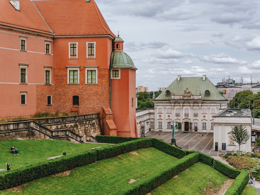
Explore the miracle of Warsaw's reconstructed Old Town on this self-guided walk through royal squares, medieval walls, and heroic monuments.
 Easy
EasyAmsterdam, Netherlands
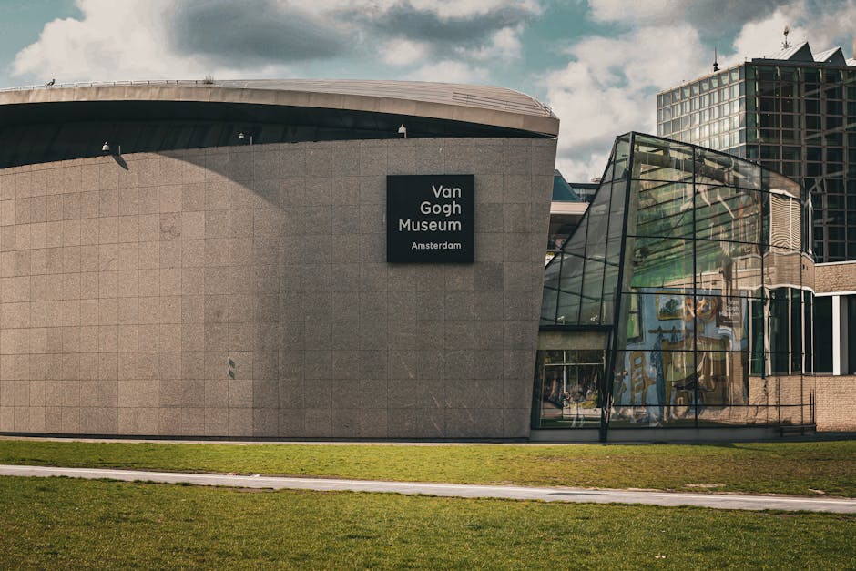
Discover Amsterdam's cultural heart on this self-guided walk from the iconic Museumplein to the serene blooming gardens of Vondelpark.
 Easy
EasyAmsterdam, Netherlands
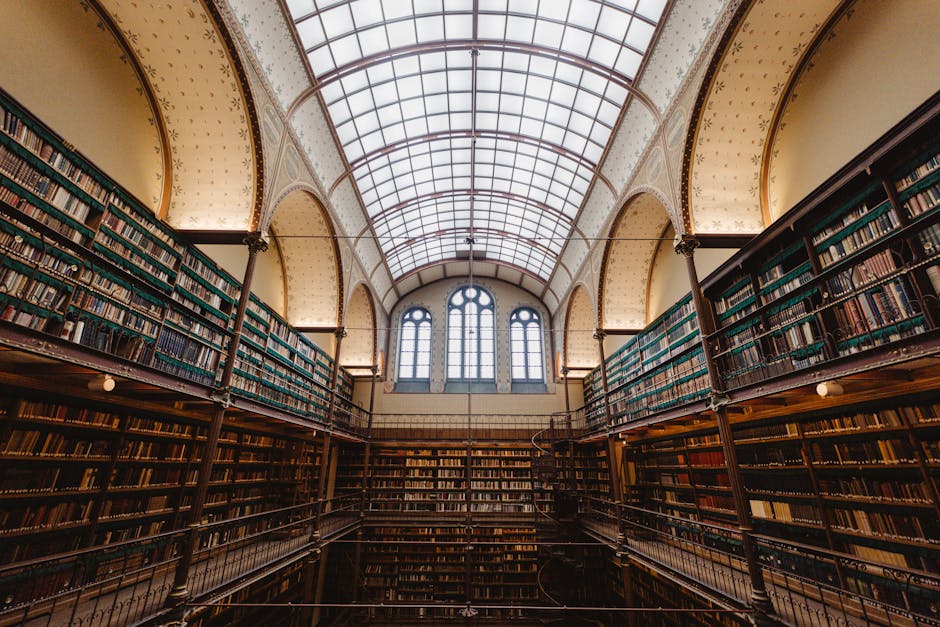
Discover Amsterdam's literary heart on this self-guided walk through historic bookshops, writers' haunts, and the homes of revolutionary thinkers.
 Easy
EasyAmsterdam, Netherlands
Capture the magic of Amsterdam with this self-guided photography walk across the iconic bridges and scenic banks of the Amstel River.
 Easy
EasyAmsterdam, Netherlands
Discover the opulent 17th-century mansions and rich history of Amsterdam's famous Canal Belt on this self-guided architectural walking route.